Earthquake of 7.6 hits Philippines eastern coast late friday, Centre was located 66 miles east of Samar Island
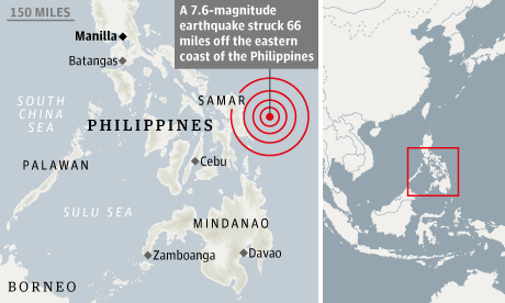
A earthquake of mangnitude of 7.6 hits Philippines easternt coast late friday. Earthquake centre was located 66 miles east of Samar Island survey said.
Earthquake resulted in killing one person in a house collapse, knocking out power in several towns and spurring panic about a tsunami that ended up generating only tiny waves.
The US Geological Survey said the quake had a depth of 34 kilometres and hit at 8:47 pm (1817 IST), 139 kilometres east of the city of Sulangan on Samar island.
Tsunami alert was orignally issued for many contries inlcuding Japana and Pacific islands but was soon lifed.
No comments:
Post a Comment